Slumps in Baird Creek Valley?
Steven Dutch, Professor Emeritus, Natural and Applied Sciences, University of Wisconsin - Green Bay
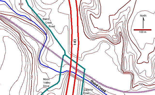
Locality Map
The localities described here are the steep hills north and east of the large flat lowland east of I-43.
 |
East of I-43 is a broad flat meadow surrounded by steep hills. Bordering the meadow is a half ring of hills separated from the adjacent hills by narrow, steep ravines. These hills appear to be slump blocks that dropped away from the original slope.
Judging from the trees on them, the slumps are now stable. They probably occurred either when stagnant ice in the valley melted, resulting in a steep unstable hill front, or perhaps when melt water pouring down the valley eroded and oversteepened the valley walls. There is no reason to consider these slumps geologic hazards. |
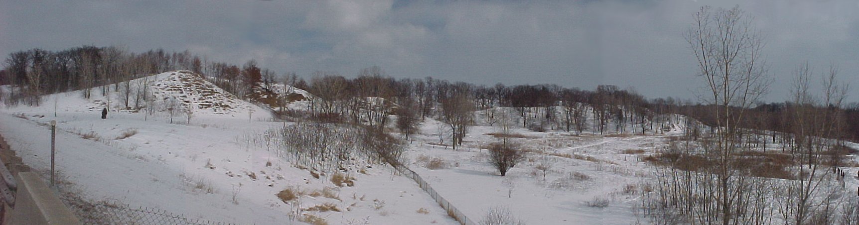
The panorama below looks east from the north end of the bridge on I-43. The flat area in left foreground is the floor of the former gravel pit. The small alluvial fan exits a small valley in the center of the panorama. The row of hills to the right, with their summits lower than the upland behind them, are possible slump blocks
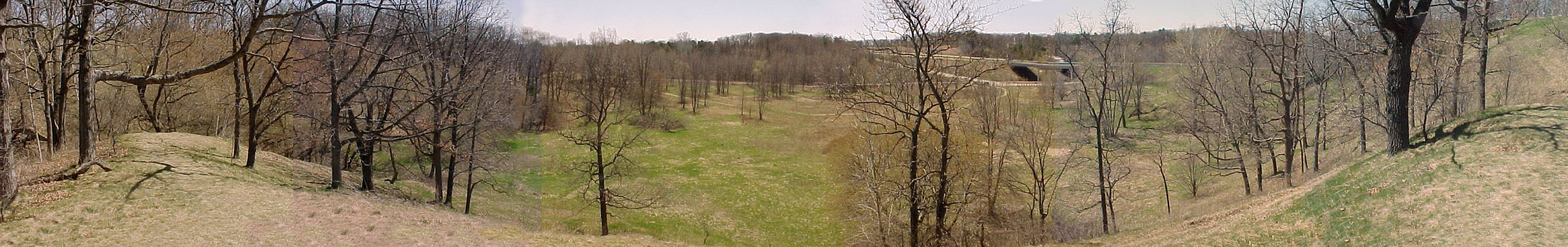
The panorama below was taken from the top of the northernmost possible slump block looking south and shows the flat meadow to the south. The saddle behind the hill is just visible at the extreme edges of the panorama. The deep ravine is just beyond the hill on the left side of the panorama and the other probable slump blocks are largely hidden in the trees along the left side of the meadow.
Return to Geology of Wisconsin Index
Return to Geologic Localities Index
Return to Professor Dutch's Home Page
Created 26 April 2000, Last Update 4 May 2000